Latest Headlines
9

Day 11 – Lots of Miles, Aided by a Strong Tailwind

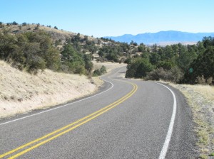
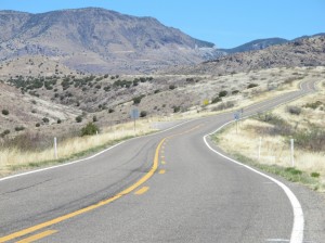
From Route 70

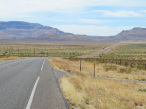
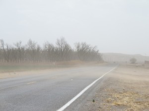
Looking out from Route 70 in the San Carlos Apache Reservation, along my route today. Click on any image to enlarge.

3 April 2011. A few people have suggested that it doesn’t really matter whether you biking east or west; you’ll find headwinds either way. Well, so far on this trip, I’ve made the right choice by a long shot! Go tailwinds!

Today, I had a 20-30 mph wind coming out of the south, west, or southwest most of the day—stronger as I got further east. Once or twice when I had to pedal the other way (going into a grocery store, for example), it became ever so apparent that it would have been A LOT harder pedaling west today!

Read the rest of this entry »
3

Day Ten – Gaining Elevation (Carefully)

Leaving Superior

From Superior, Route 60 rises steeply for 2,400 feet. The shoulder here is pretty good. That didn’t last! Click to enlarge any of the photos.

2 April 2011. In terms of miles, this was an easy day—only 24. But in terms of effort, concentration, and adrenaline, it was a challenging day. I had been warned about the Queen Creek Tunnel and this section of Route 60 by lots of people—and the warnings were well-founded.

Leaving Superior, Highway 60 climbs steeply right away. About two miles out of town, you pass through the infamous tunnel—peddling uphill with cars, trucks, and (loud) motorcycles racing by you at 65 mph. There are two lanes eastbound here, but virtually no shoulder. Some people suggest trying to hitch a ride through the tunnel in a pick-up truck; someone else was trying to navigate a route around the tunnel. But I psyched myself up and went for it.

Read the rest of this entry »

3

Day Nine – In Which I Make My Escape From the City

A canal path

Long shadows in the early morning light on this unpaved canal trail; I’m facing west here. Click on image to enlarge.

1 April 2011 (posted a day later). I left the Dalrymple’s place at Chimney Rock fairly early—to try to beat the heat. The forecast for Phoenix was 99°F (and I heard tonight that the city tied a record of 100°). I got off by 7:15, after a packing and eating a bowl of cereal.

The trick was getting down to where I would pick up the Adventure Cycling route. The night before I had checked Google Maps and figured out what seemed like a good route. I started out just fine—riding downhill, then getting on one of those canal paths. At one point, though, I seemed to get off the route I had scouted, so I just tried to head east and south. Even without a compass, that’s pretty easy in a place like Arizona, where most streets are either north-south or east-west. In the morning, either you’re squinting into the sun, or it’s hitting the side of your face, sneaking past the edges of your sunglasses.

Read the rest of this entry »

2

Day Eight – Through the City, Hidden From View

Dockside estates

I thought I was in the desert, not Florida! Everywhere I turned there was water in the Phoenix area. This was in Sun City, shortly after heading out. Click on image to enlarge.

31 March 2011 (posted a day later, from Superior, AZ). I left my WarmShowers hosts late morning, after catching up on blogs and making some lodging arrangements. It was nice to relax a bit. Larry had provided me with detailed instructions for getting on my way.

Whenever I’m in an arid area, I love to look at how adaptation to the climate is handled. The dockside homes above are a particularly bad example of climate-responsive design. But I did see lots of features that made sense, such as low-water landscaping (xeriscaping). The multicolor stone mulches add a bit of color!

Read the rest of this entry »

9

Day Seven – Wickenburg and Into the Megalopolis

On Route 60, passing Black Mountain

I never thought I’d look forward to a climbing up and around a mountain, but after about 100 miles of straight-as-an-arrow roads, it was great to have a change! Click on image to enlarge.

30 March 2011. Today was a relaxing day, though I did pedal 66 miles. I got a much earlier start than the day before: leaving around 7 am. After the straight-line Route 60 from Quartzsite, this section finally had a bit of a hill and some curves. I never imagined I would like a hill!

As we rose (only about 600 feet), the vegetation became more interesting. Saguaro, hedgehog, barrel, and prickly-pear cactus, Ocotillo (is that a cactus?), yucca (Joshua Tree), palo verde, mesquite. From my bike, I scanned Black Mountain hoping to spot a desert big-horn sheep, but no luck—it would have required extraordinary luck.

Read the rest of this entry »

6

Day Six – Slogging Along the Straightaway

Stopped at a store along Route 60

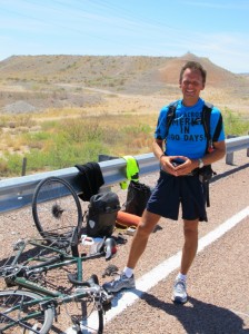
Taken by Dan, a fellow biker during a rest at a store on Route 60. Click on image to enlarge.

29 March 2011 (posted on the 30th from Wickenburg). Aguila, Arizona is about as different from Quartzsite as you can get. It is extremely poor, run-down, depressing. The motel I’m staying in (Burro Jim’s) is even less expensive than my accommodations last night ($50—cash). It’s a vinyl flooring and BYOS sort of place (bring your own soap), but the shower works and I was able to scrape off the dust-infused sunblock that left my arms and legs gritty and sticky.

Read the rest of this entry »

6

Day Five – Made it to Arizona

Pink Catcus

I haven’t identified this cactus yet, but it was growing along I-10 in the Dome Rock Mountains. Click on image to enlarge.

28 March 2011. Quartzsite, Arizona isn’t my model of an ideal town. It’s a town of truck stops, fast-food restaurants, and—apparently—it hosts the largest gathering of RV’ers in the world. Each January, 750,000 to one million people converge on the town, mostly in RVs, for a week of massive flea markets and whatever else RV’ers do. The town is also well known in the rock & mineral crowd, do to the rich geology here. (I’m okay with that!) Just last week there was apparently some huge show; this is clearly the town’s angle, and I guess they do it well.

But all those people aren’t here right now—which is just fine with me! I arrived late afternoon, coasting down from the I-10 snaking corridor through the Dome Rock Mountains that lie between the Arizona border and here. After 84 miles yesterday, I took a more relaxed pace today, logging 49 miles (though my bicycle odometer/speedometer seems to crap out now and then—I’ll look down at it and see 0 mph, when I’m fairly certain that I’m going somewhat faster than that).

Read the rest of this entry »

4

Day Four – A Long Day Through the Dunes

Leaving El Centro

Leaving El Centro. Note the Sea Level marker on the tank! Click on image to enlarge.

27 March 2011 (posted on 3/28 from a Starbucks in Blythe, CA). I started the day in El Centro and pedaled all the way to Palo Verde, which is about 25 miles south of Blythe, California, and just across the Colorado River from Arizona.

El Centro seemed to go on forever—seeming far larger and spread out than its 38,000 population might suggest. I didn’t see the town center; I skirted it as I was heading for a route that Brian had suggested—much better bicycling. And, indeed, the old Route 111 was smooth with wide shoulders and virtually no traffic—cars and trucks choosing the new Route 111 that parallels it the whole way up to Route 78—about 15 or 16 miles. That would be the best pedaling all day by a long shot—at least relative to the safety and quality of the road surface.

Route 78, which I pedaled on most of the day, and will take almost to Blythe tomorrow, started out fine, relative to the shoulder. Not a really wide shoulder, but wide enough. It was pretty bumpy, though. We have frost heaves in Vermont. Here, they have heat heaves I guess. About every 20 feet a jarring bounce.

Read the rest of this entry »

5

Day Three – Downhill and Downwind

Leaving the Pine Valley Inn Motel

All packed up and out by 8:30–later than I had hoped. Click on image to enlarge.

26 March 2011. Before I get into today’s pedaling adventure, I have to relate a follow-up to yesterday’s story about my recovery from the cold at the Descanso Junction Restaurant—my salvation from poor planning.

As soon as I turned out the light in my motel room last night (at the Pine Valley Inn and Motel) and began thinking over the day—a flow of mine that often keeps me from falling asleep quickly—I realized that I hadn’t hung up my yellow biking jersey to dry with all my other gear. Where was it? I turned on the light and looked through everything. It wasn’t there!

After a bit of reflection, I realized that I had left it at the Descanso Junction Restaurant—perhaps my mind still addled by the cold. I had hung it up to dry on a hook on one side of my booth and my raincoat on another. Both dried nicely. I realized that I must have neglected to grab it after donning my other (warmer) clothes.

Read the rest of this entry »

2

Day Two: Few Miles, But Up…and Wet

Getting ready to head out from the Ayers Hotel in Alpine

I thought I was dressed all right for the day’s uphill peddle, but that wasn’t the case. Click on image to enlarge.

25 March 2011. It was gray when got up this in Alpine this morning. The forecast had indicated a chance of showers. It looked as if it had been gently misting.

Following breakfast, a bit of time on my computer posting a blog from the previous day, and my adventures with the Post Office (see previous post), I was ready to head out. I was under the entry overhang coating my bike chain with this protective lubricant that the guy at the bike shop in Brattleboro said was the cat’s meow. I figured if I was going to be biking in a light drizzle, I should coat the chain first.

The manager of the hotel came out and very kindly brought me a rag to use—and another to bring with me. Really nice guy. I think the hotel caters to bicyclists to some extent. When he saw me taking a photo of the bike, he offered to take one of me (first one here).

Read the rest of this entry »