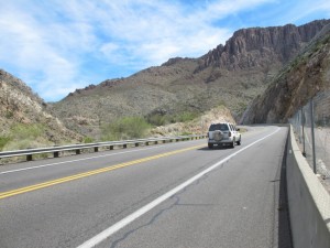
From Superior, Route 60 rises steeply for 2,400 feet. The shoulder here is pretty good. That didn’t last! Click to enlarge any of the photos.
2 April 2011. In terms of miles, this was an easy day—only 24. But in terms of effort, concentration, and adrenaline, it was a challenging day. I had been warned about the Queen Creek Tunnel and this section of Route 60 by lots of people—and the warnings were well-founded.
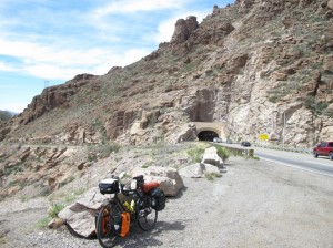
Leaving Superior, Highway 60 climbs steeply right away. About two miles out of town, you pass through the infamous tunnel—peddling uphill with cars, trucks, and (loud) motorcycles racing by you at 65 mph. There are two lanes eastbound here, but virtually no shoulder. Some people suggest trying to hitch a ride through the tunnel in a pick-up truck; someone else was trying to navigate a route around the tunnel. But I psyched myself up and went for it.
In Superior, in the morning, my one important task was fixing my rear LED warning light. I wanted a red flasher as I biked through the tunnel. The day before a piece of Velcro that I use to adhere to light to the tool bag under my seat had come unglued. The only reason I didn’t lose the light is that I have a tether for when the Velcro bounces loose. I had to wait until the Dollar Store across from my motel opened to pick up some Super Glue. I was pleased to find that I could buy just a tiny container of it for something like $1.10, rather than buying $8 worth and using only a few drops. The repair seems to have worked.
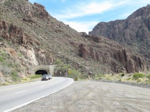
Approaching the Queen Creek Tunnel. I stopped here to turn on my headlight and newly re-glued blinking rear light.
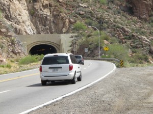
Note that the shoulder disappears after this pull-over area. The passage on a bike, in low-low gear, is quite nerve-wracking.
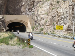
They’re not big into mufflers on their Harleys out here, which is quite noticeable when a whole pack of them roar past you in a tunnel!
But the ride through the tunnel was certainly harrowing. When ten Harleys zoom past at full-throttle, the noise is deafening!
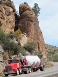
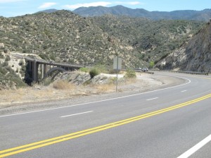
Before and after the tunnel, Route 60 is anything but an easy ride. When there is just one eastbound lane, it’s not too bad, with perhaps three feet of shoulder. But when there’s a passing lane, the shoulder disappears, and you pretty-much have to ride on the white line. At some places there’s a foot of drop-off right at the outer edge of the white line (or even cutting off part of the line). And those vehicles keep streaming by!
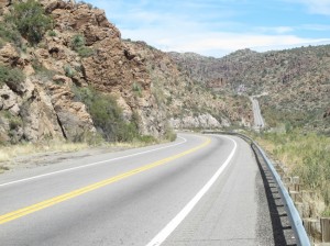
Note that when there’s only one eastbound lane, the shoulder is much more reasonable; you’re separated by the traffic by rumble strips.
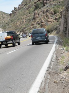
When there’s a passing lane, the shoulder pretty-much disappears, and there’s often a significant drop-off. Don’t tell my wife about this!
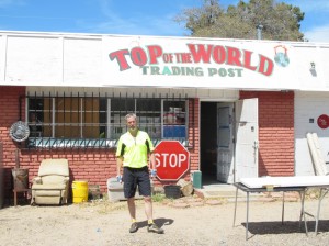
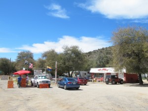
Yours truly, taken by the guy selling jerky at the road; he comes up every weekend from Mesa, outside Phoenix.
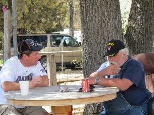
I bought a Coke from the proprietor (on the right); the guy on the left buys jerky wholesale and sells it here each weekend. The three of us enjoyed a nice chat, and the bearded fellow told me about the BBQ in Globe.
Route 60 rises in elevation about 2,400 feet from Superior to the top of the pass, which is at about 4,600 feet. Then there’s lots of downhill—with the same narrow or non-existent shoulder. I could only stop to take photos where there was a pullout.
Coming down into Miami, Arizona, everything is about copper. I passed a huge open-pit mine just to the north. There are two smelters in town, and vast tailings piles where restoration is being attempted. I had hoped to learn more about the mining here, but when I stopped at one of the mine entrances I was told a tour wouldn’t be possible during the weekend, and the museum here closed at 3 pm. I believe I pass another big mine in New Mexico; maybe I’ll have better luck then.
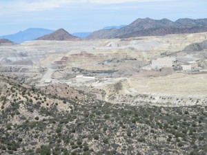
It’s all about copper in Miami and Globe, Arizona. I passed this open-pit mine on the way down from the pass.
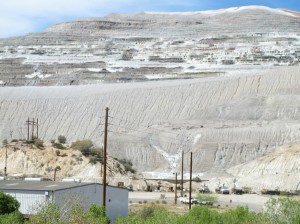
Another copper mine, just outside of Miami. This one may be inactive, with land reclamation going on.
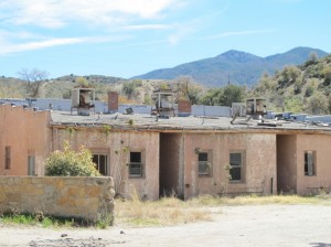
The prosperity of Miami and Globe rises and falls with the price of copper. This is likely evidence of a past slump; today, the price is back up.
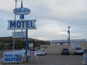
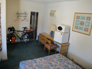
Yesterday, when I called about lodging for tonight, I couldn’t understand the thick Indian or Pakistani accent of the woman at the Bell-Aire Motel. (I always seek out the non-chain-sounding places.) I thought she said rooms are $27.50; I was hoping I hadn’t misunderstood and they were really $127.50. Nope: $27.50, plus tax comes to $30.40. Cash only. But it’s actually about the best shower I’ve had (despite the lack of a soap dish). They had soap, there’s carpeting—all those luxuries! A little deferred maintenance may be needed, but hey, at thirty bucks for a night’s stay I’m sure not complaining. When the first room I ended up in smelled really smoky, she moved me to a different room; this one’s fine.
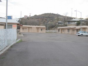
I’m in the far building—the room on the right. I asked to be as far as possible from the highway; I hear enough of those cars and trucks during the day!
And right next door (same parking lot, really) is Hog Haven, a great BBQ joint. It caters to bikers, so there were lots of interesting bike mags to look through, but then I got into an interesting conversation with a miner from an Indian Reservation about 25 miles west of Albuquerque. He’s been working here at a local mine for the past month, driving those big trucks. Nice guy; we talked about traveling and bicycling. Though he’s not the bicycling type, he thought what I was doing was great.
That’s in sharp contrast to a waitress at another locally owned restaurant on the other side of town where I stopped for an early-afternoon milkshake. She thought us bicyclists were totally crazy. “Why would you want to put yourself through so much pain,” she asked? When I tried to explain that it’s a way to get away from the routine and see some country, she countered that you can see country from a car just as well. She told me that she lives 30 miles out in the desert where she’s surrounded by wilderness. She doesn’t have a television, so doesn’t have to expose herself to all the strife in the world. It was a good conversation; I was impressed that she stuck to her guns.
My plan tomorrow is to get up and out fairly early and get all the way to Safford, Arizona, about 80 miles from here. There’s not much climbing, but apparently there are loose dogs to watch out for in the San Carlos Apache Reservation. My knees felt better today than the day before, so I think I’ll do fine. I just checked the weather, and it’s going to be cooler (high of 75 in Globe tomorrow) and quite windy, with gusts in Safford as high as 40 mph—fortunately I’ll be going in generally the right direction!
That photo of Route 60, white line with no shoulder, and rock walls rising immediately from the side of the road reminds me of riding around our roads in Vermont! Sounds like it was a challenging day!
Good lucks with those dogs!
That was one of the more challenging sections of the whole Southern Tier and it’s behind you now. Yeah!