What spectacular weather today! High in the mid-70s, sunny most of the day. A gentle breeze, but not too strong….
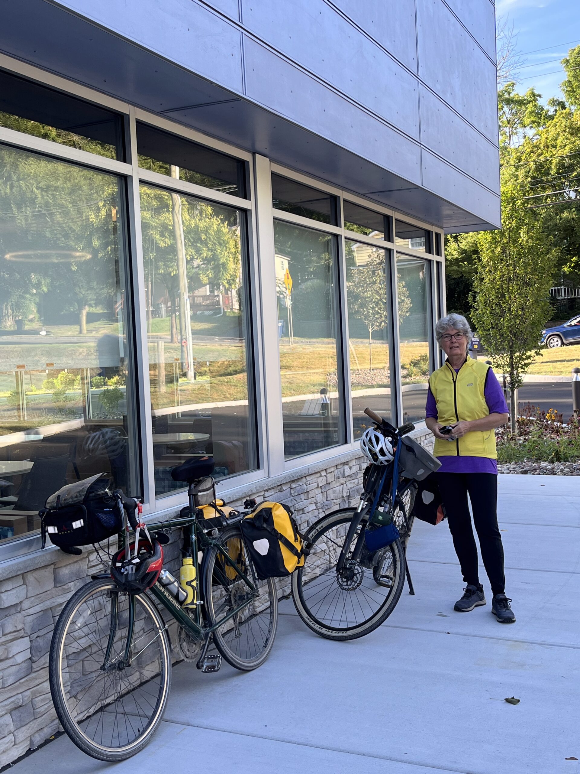
Departing the new Microtel Hotel in Newark at 8:00 am.
The trail on the first segment of the ride—from our hotel in Newark to Community Coffee (a small breakfast and coffee spot) in Lyons—was the most beautiful I’ve seen on the western half of the Erie Canalway Trail. It follows the original route of the Erie Canal—a section where the canal was relocated when it was enlarged during one of several expansions of the canal. The tow path was heavily wooded and the canal much narrower than the Barge Canal that has become the travelled canal today.
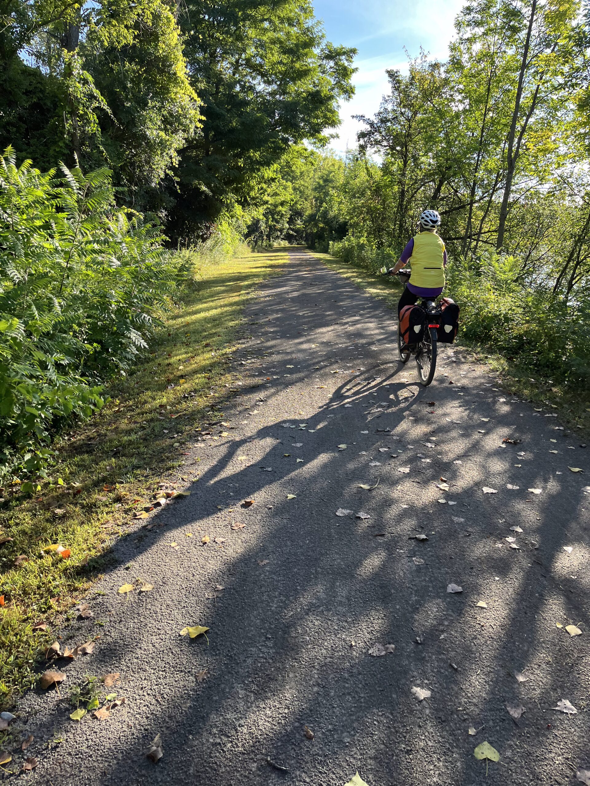
A spectacular trail section along the old Erie Canal.
The trail here seemed incredibly well-maintained. It had recently been mowed, and the low morning light filtering through the trees made the trail seem to sparkle!
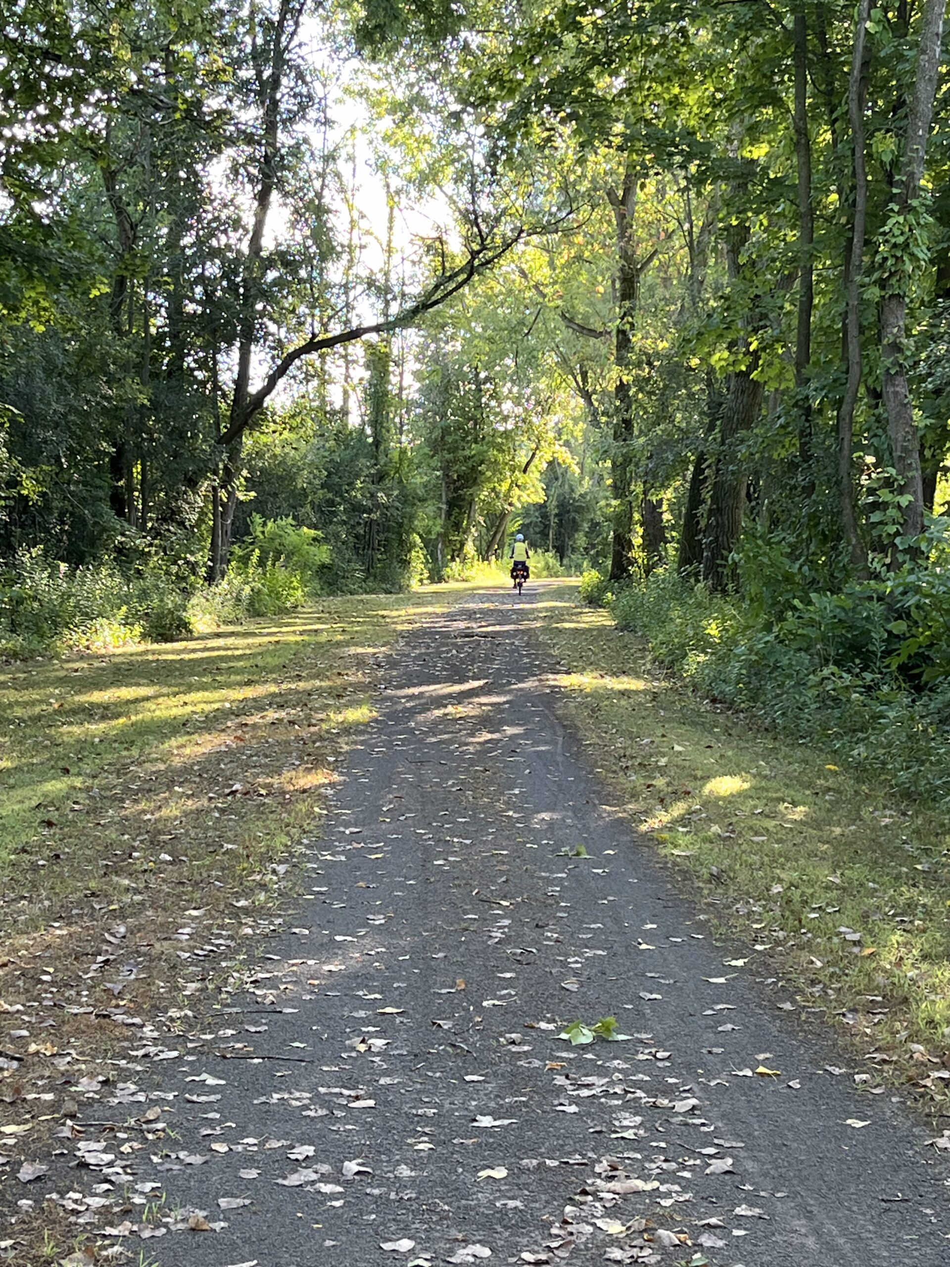
This area almost felt like the bayous of the Southeast.
The coffee shop was nice. No fancy espresso machines and eight-dollar lattes, but I had a good cup of coffee and bagle with cream cheese; Jerelyn enjoyed a far healthier veggie breakfast sandwich. I wish I had gotten up courage to chat with the group of older men sitting at the only other occupied table (on the same morning when I normally meet with a group of men at the Brattleboro Food Co-op Cafe). I could hear that they were talking about Trump and Putin, but I couldn’t really make out their leanings. I’m just not bold enough, and my extrovert wife didn’t step in….
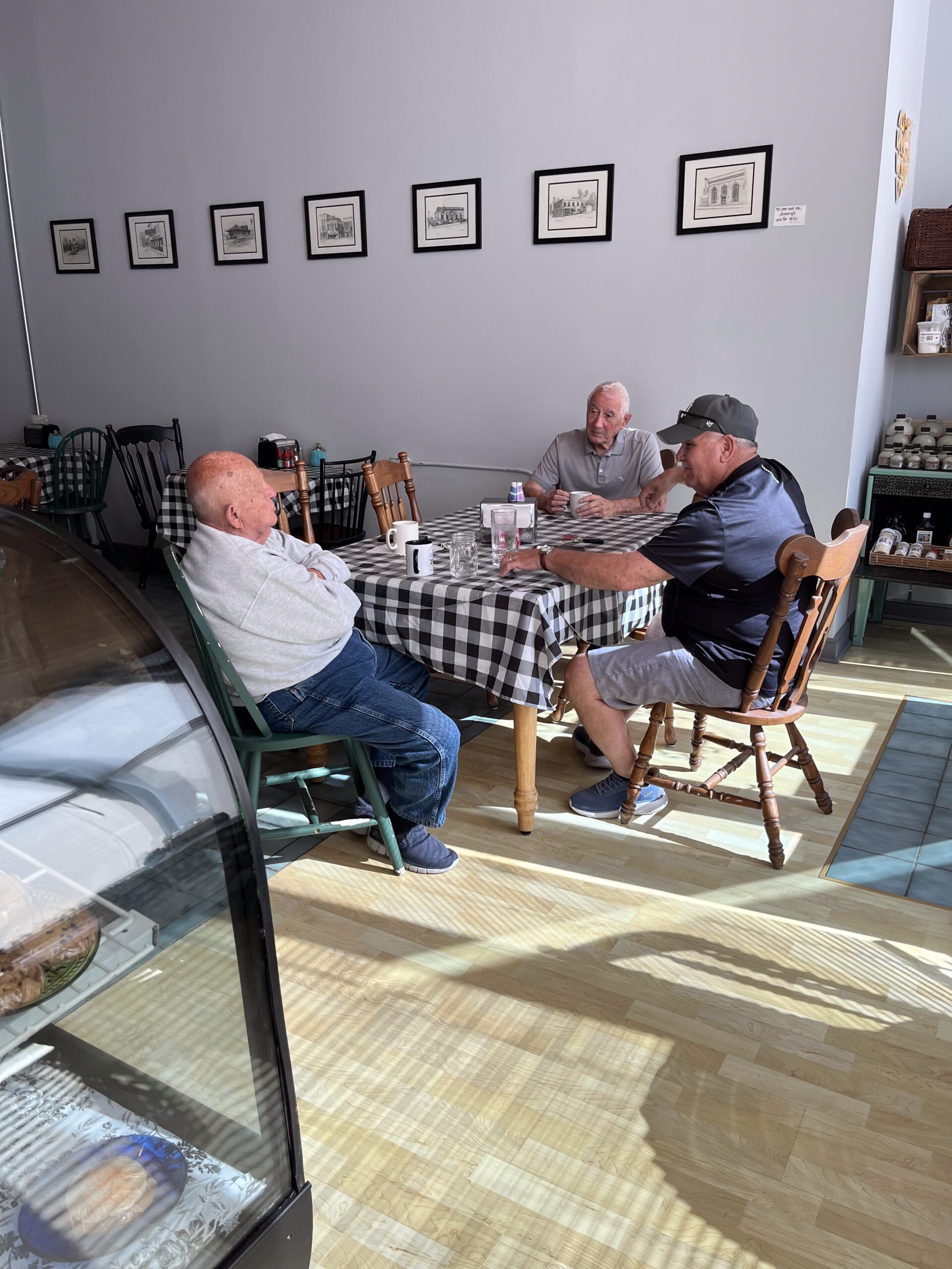
How I wanted to join their conversation about Trump and Putin!
The trail continued along the old Erie Canal, some of which is now filling in, to Clyde. Along here we passed the ruins of historic Lock Berlin (#54) with trees now growing out of the blocks of stone from which it was constructed. This lock is 214 miles west of Albany and 138 miles east of Buffalo, and it became operational in the 1850s with a lift of 7.7 feet.
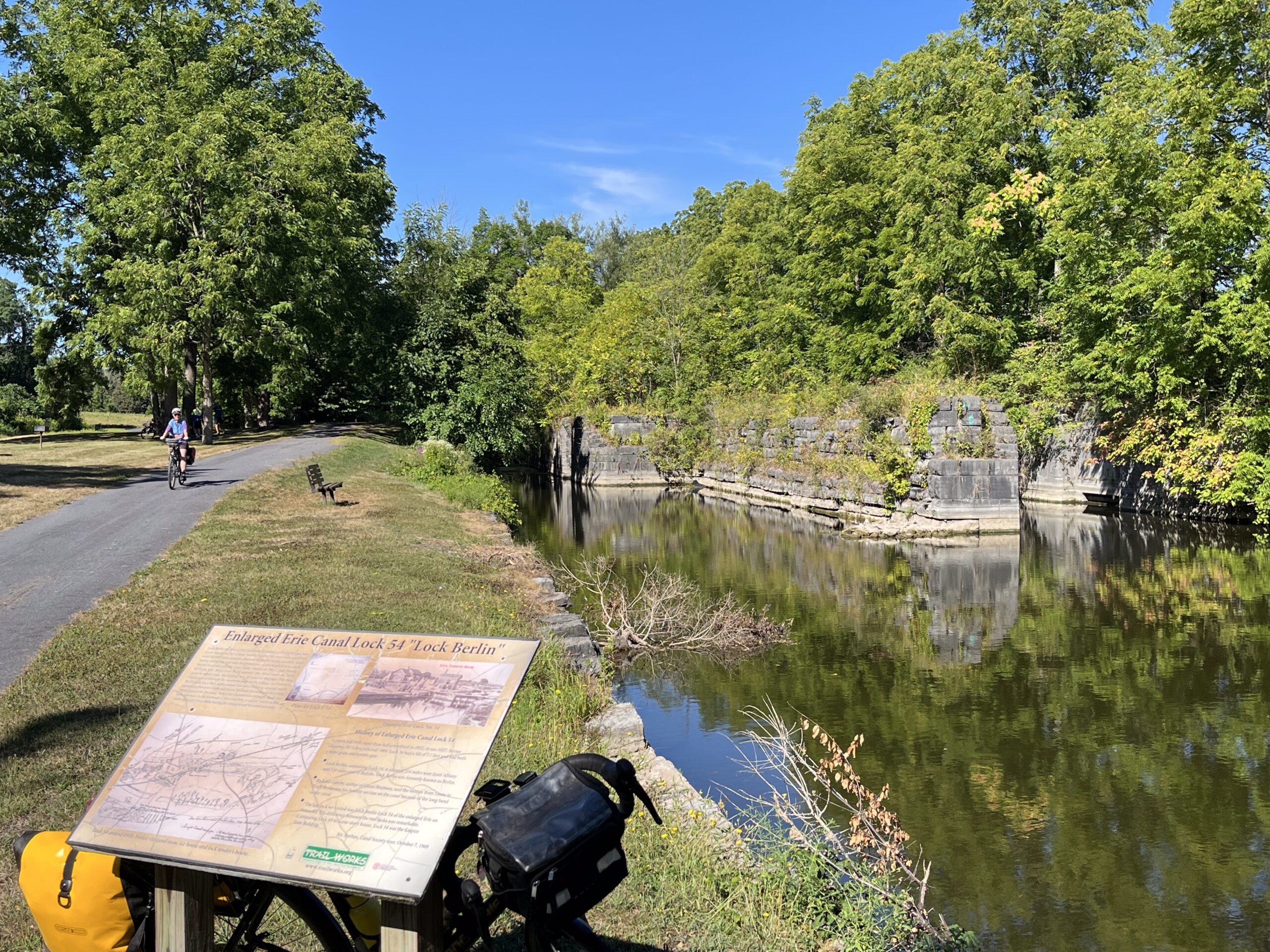
Remains of the old Lock Berlin.
As we got into Clyde—somehow getting off the proper route of the Trail—we heard cowbells, and a man at the Clyde Visitor’s Center was beckoning us over. We obliged and learned a bit about the town, including where a new coffee shop was located, where I got a muffin and latte.
From Clyde, though, our directions got all screwed up. Between Clyde and Port Byron is the longest section of the Eric Canalway Trail that is on-road, and we relied on Google Maps instead of the Empire State Trail signage to guide us. Google got very confused and seemed to be leading us in circles. At one point, we were told to turn left into the woods, where there might once have been a track of some sort, but clearly isn’t today!
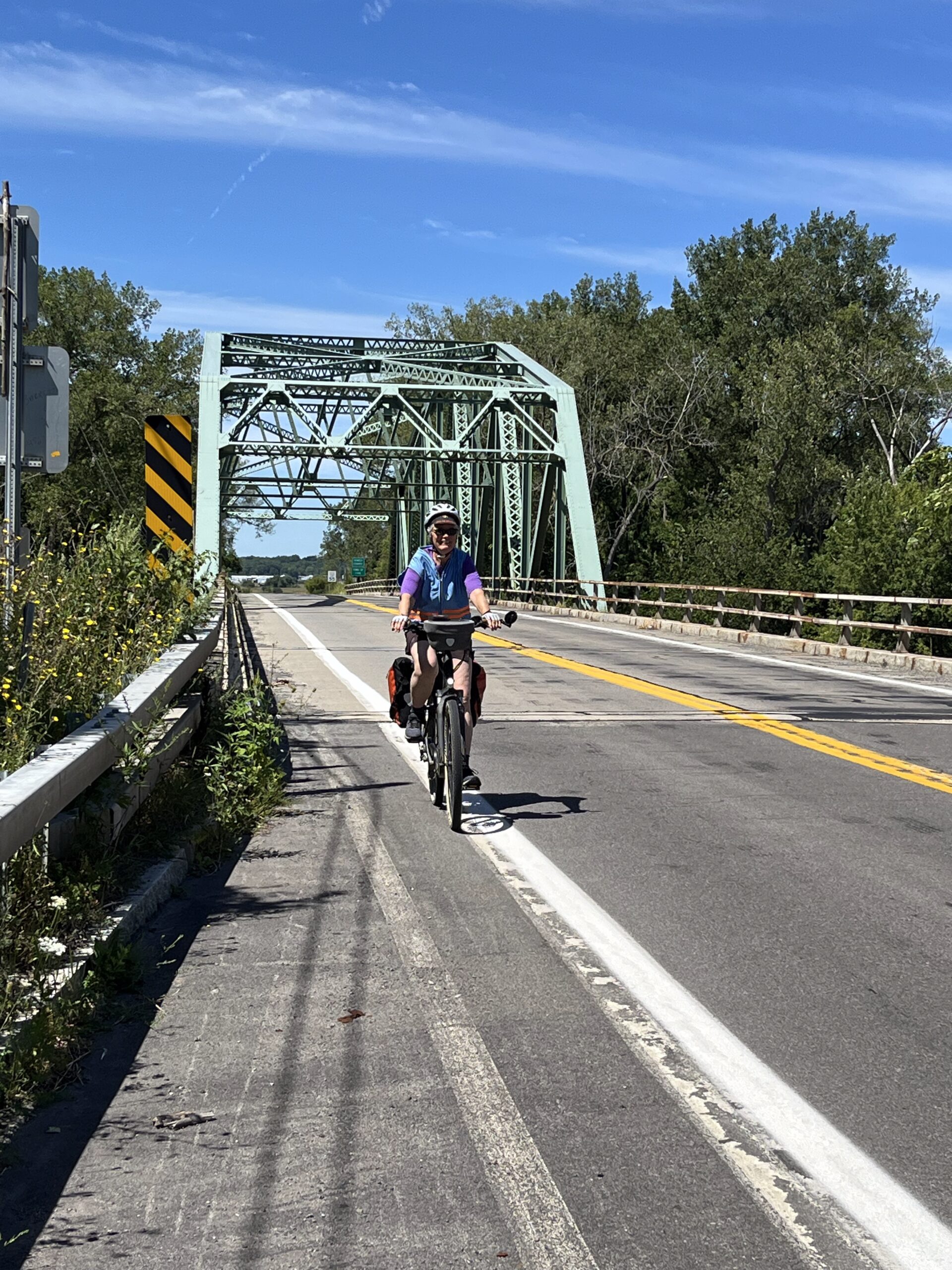
Crossing over the Seneca River on Route 31.
We finally asked someone for directions into Port Byron, and we were directed onto Route 31 (“New York Bicycle Route 5”). There was a reasonable shoulder for most of it, but way too many huge tractor-trailer trucks and speeding pickups for comfort. At one point, I braced myself when a smallesh car passed me with flashing yellow lights and an “Oversize Load” sign; moments later a modular house screamed by, nearly sucking me into its slipstream! But Jerelyn and I managed all right.
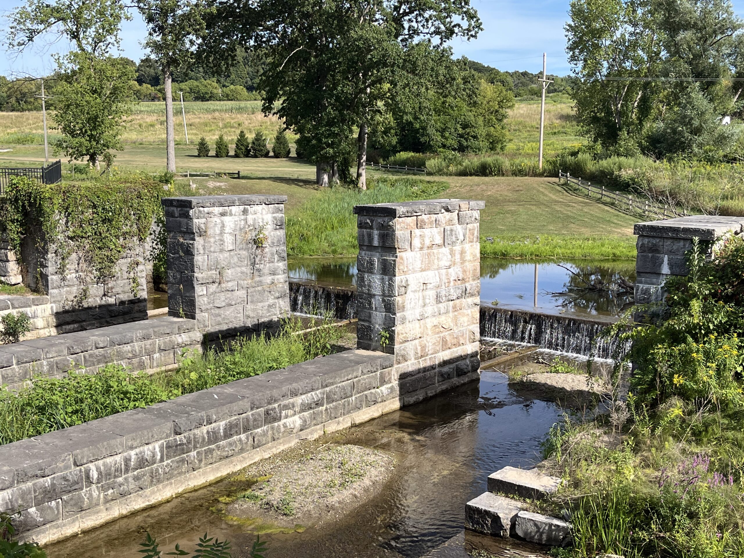
A silver lining of this segment of today’s ride was passing a sign for a Montezuma Town Park just after crossing over the Seneca River. Jer, who was ahead at this point, called to me, “Don’t you want to stop?” It doesn’t take much to temp me with diversions, so we turned around and locked our bikes at a kiosk. There was a network of trails. I got out the binoculars and we started off on on a two-mile walk on several of the trails. We were particularly intrigued by reference to the Seneca River (or Richmond) Aqueduct.
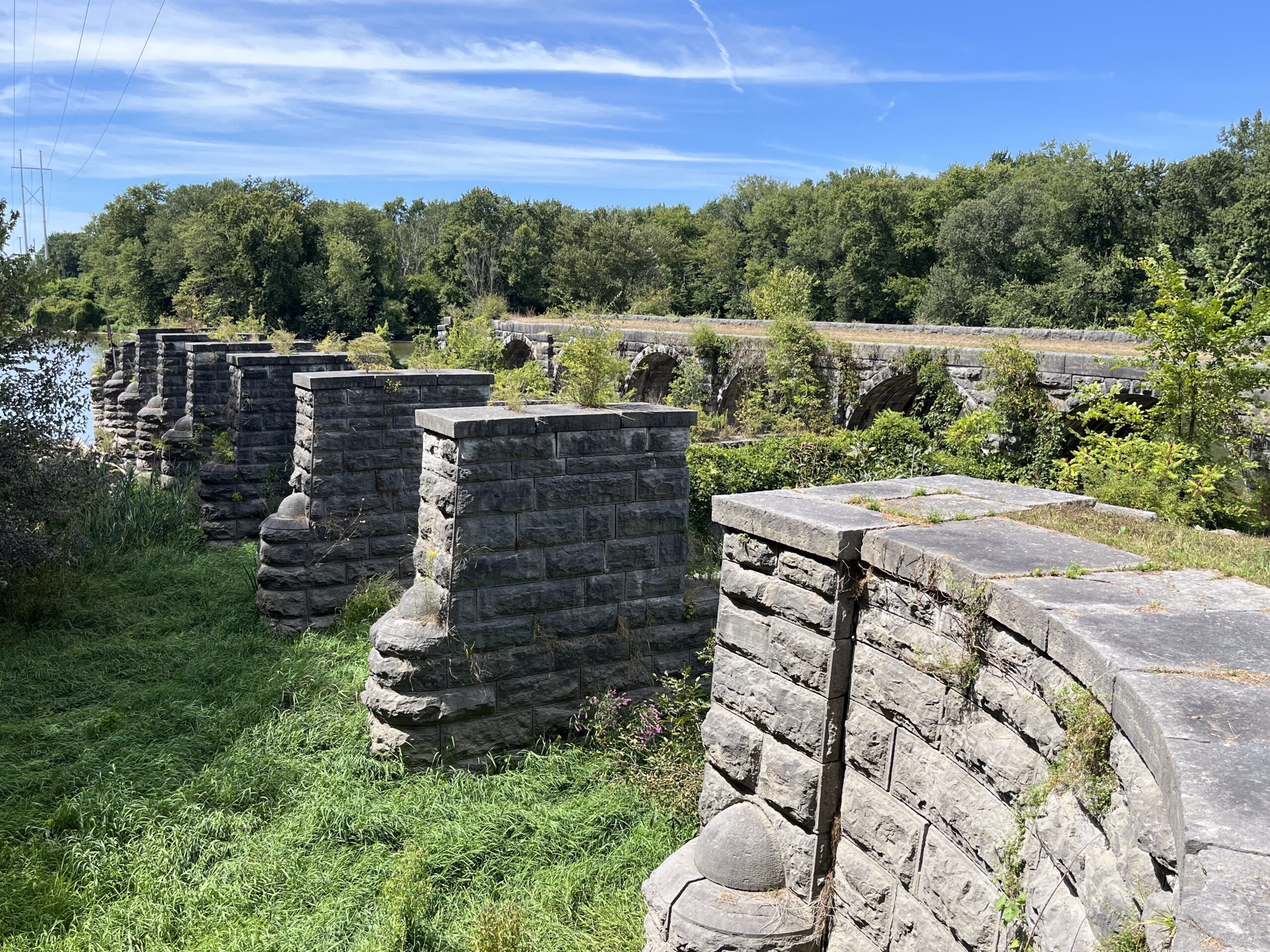
The Senaca River Aqueduct, where the canal was once carried OVER the Seneca River!
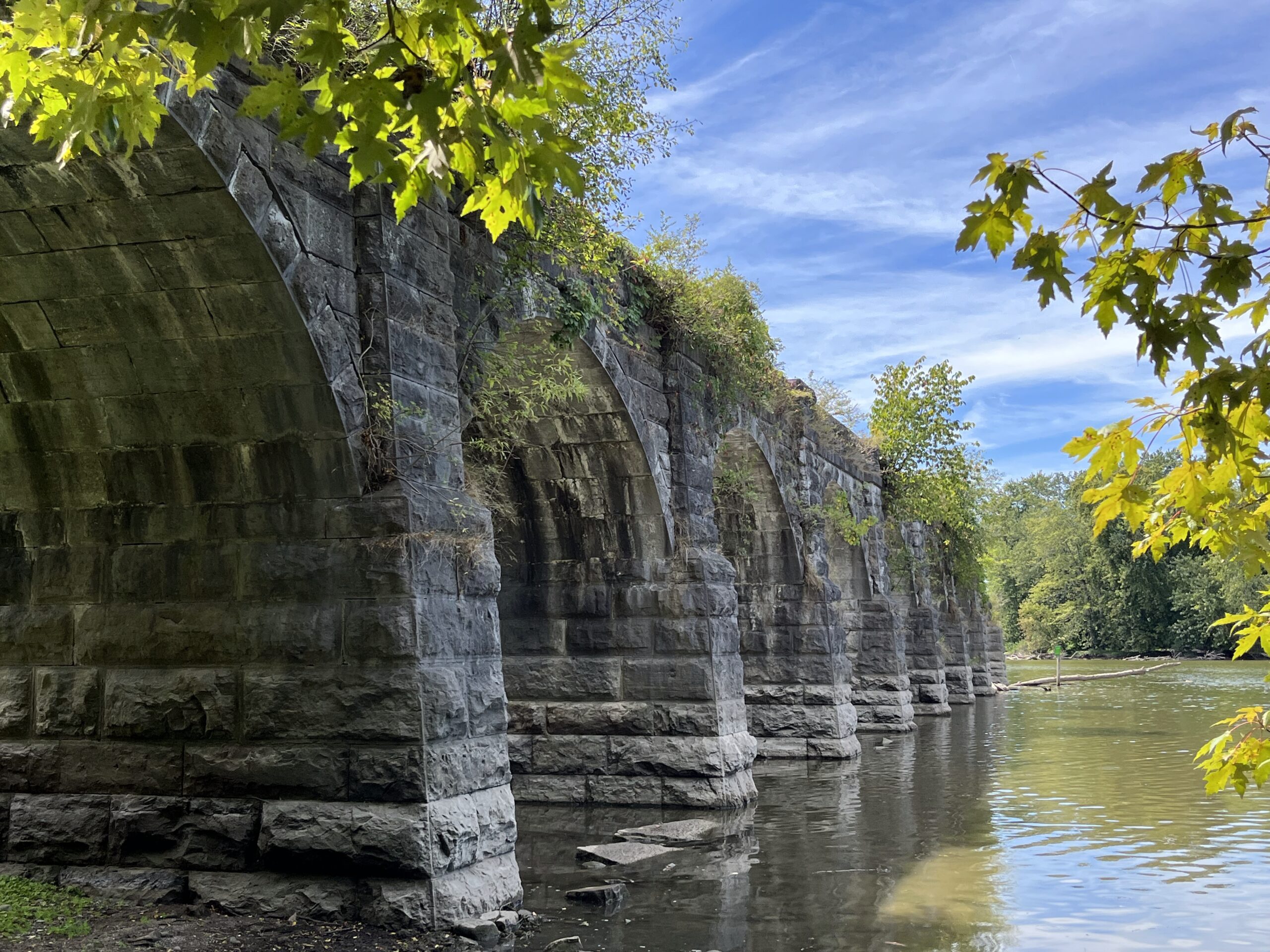
Another view of what remains of the Seneca River Aqueduct.
The trail we took lead us the long-way-around to what remains of this Erie Canal feature, and it will be one of the highlights of this trip, for sure! The 830-foot-long aqueduct originally had 31 stone arches that supported heavy timbers that, in turn, carried the canal OVER the Seneca River. This is the second-longest aqueduct on the Erie Canal. (I hadn’t even realized that aqueducts were a thing on the Erie Canal!). When the canal was enlarged to form the New York State Barge Canal, the aqueduct was dismantled, removing all but nine of the stone arches—pictured above.
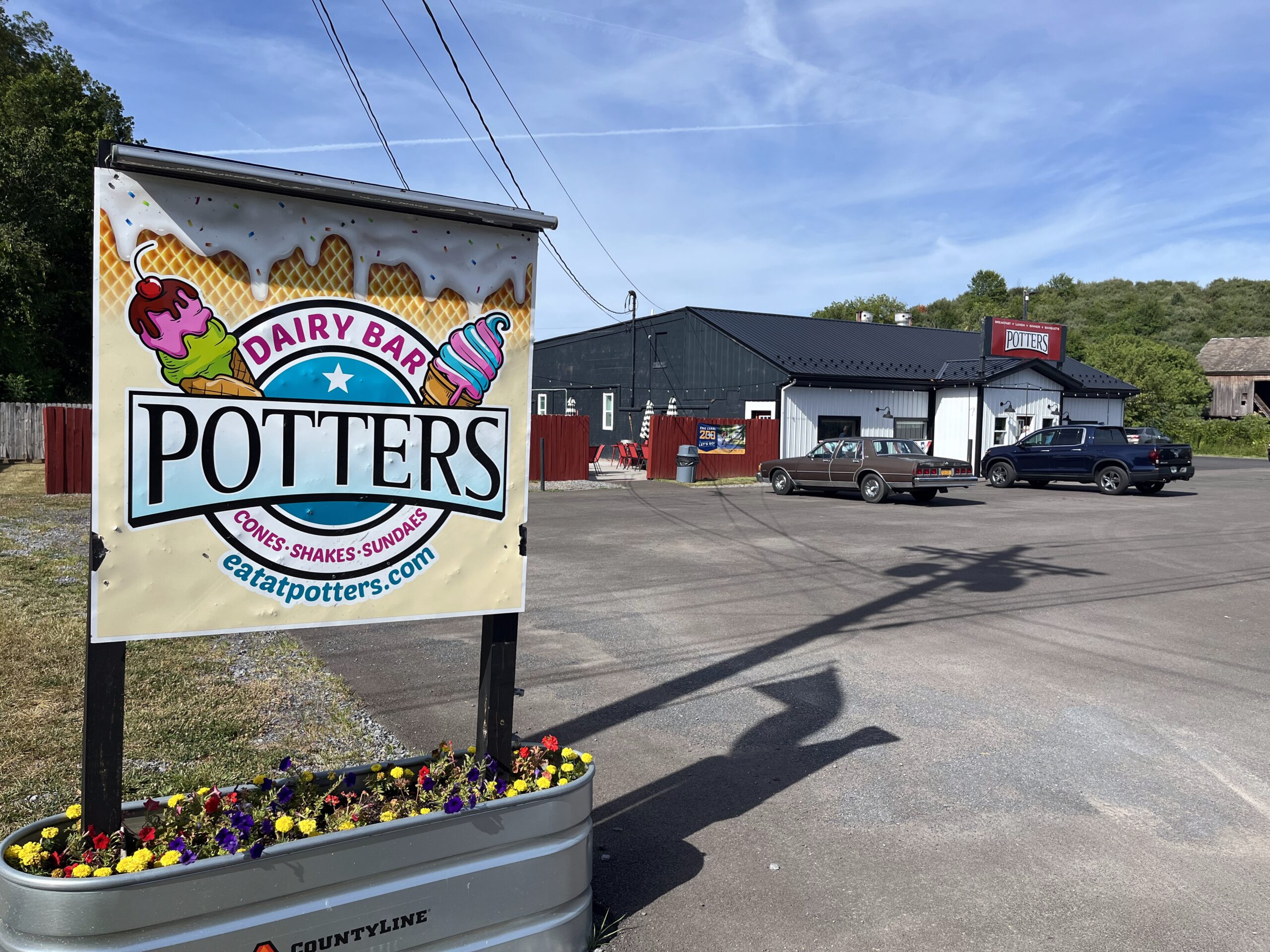
We made it into Port Byron and had a late lunch (early dinner!) around 3:45. It was a place called Potters Farm to Plate. If we had had the energy, we might have biked back this evening for live music, but we didn’t. And we ran into our friends from Washington, DC, whom we’ve seen every day.
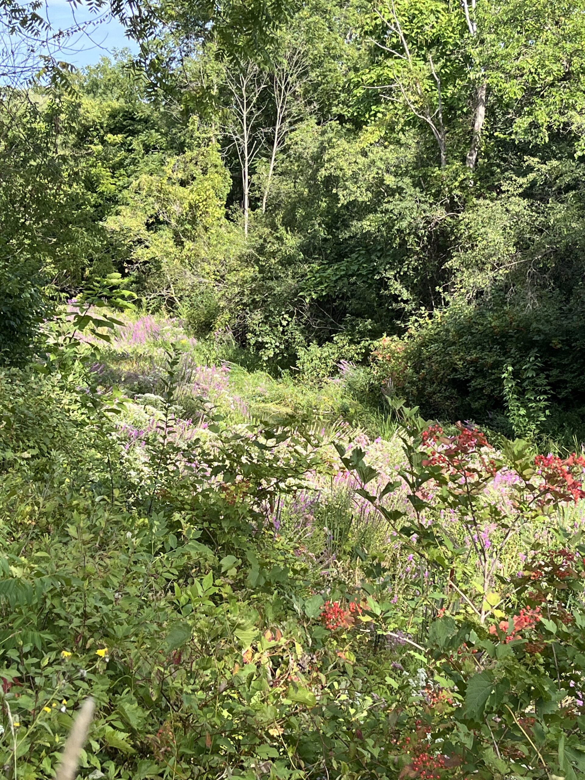
After this, we were finally got back on the actual Erie Canal towpath. We biked along a spectacular section with some wild red current bushes and purple Joe-Pye weed and purple loosestrife behind it. Despite the purple loosestrife being invasive, it was gorgeous!
Thick vegetation along the old Eric Canal bed as we got into Weedsport.
In Weedsport we came across another awesome public park. Here was another old aqueduct (the Centreport Aqueduct), with the remains of it well preserved and described with signage. There is also quite an amazing Vietnam Memorial in this park, with photos durably reproduced on black marble; I’ve never seen anything quite like it!
Ruins of the Centreport Aqueduct in Weedsport.
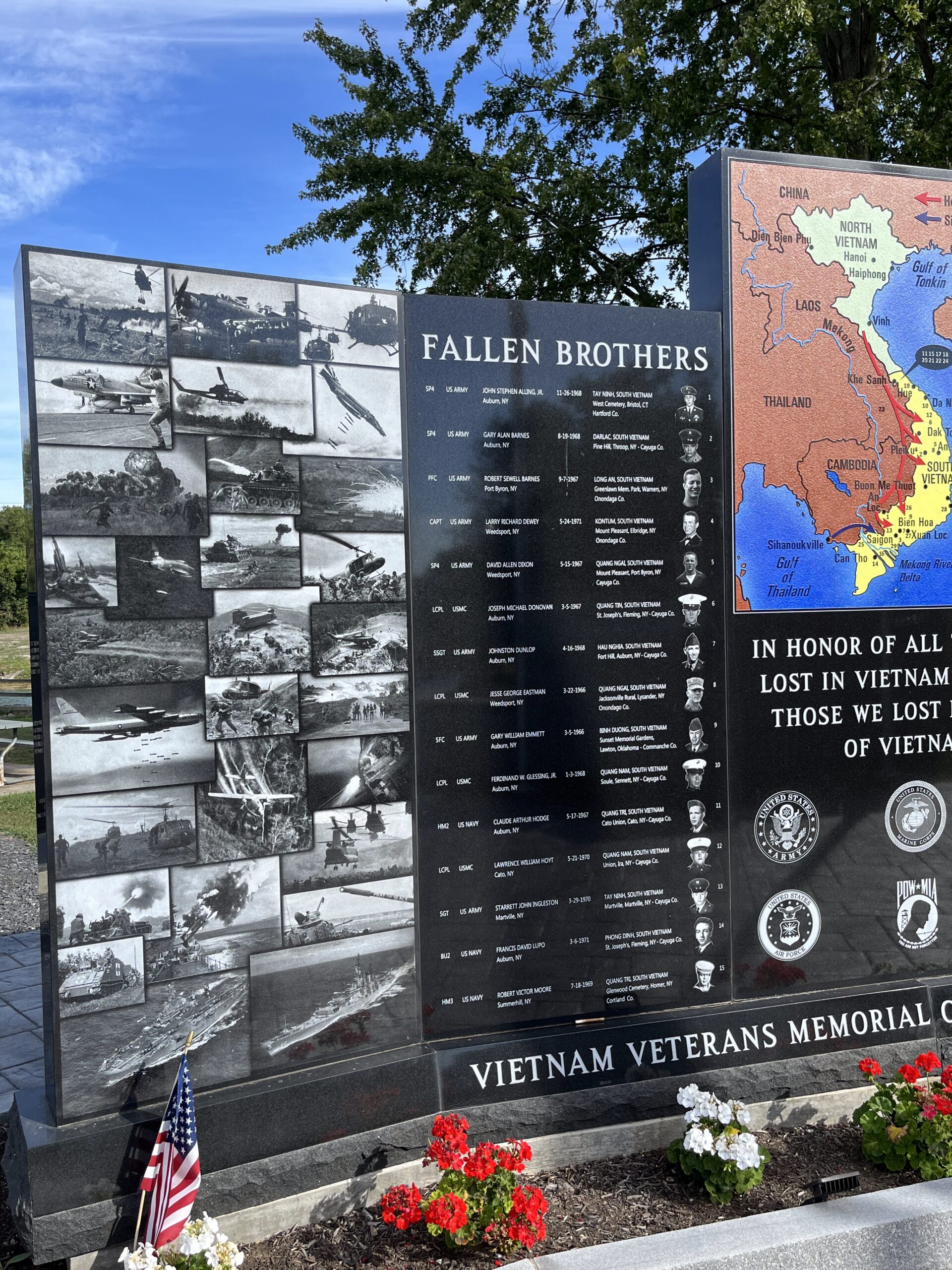
A Vietnam Memorial at the Weedsport park. The photos appear to be laser-etched into the polished black marble, creating durable black-and-white photos that are remarkable good.
Anyway, today was a great day. Jer and I biked 42 miles, including a few miles out-of-the-way as we were led astray by Google Maps. We’re staying at an okay Rodeway Inn in Weedsport; nothing to write home about, but clean and serving our needs.
Tomorrow, according to our plans, will be our longest day: 49 miles, not including some tengents off the trail looking for breakfast or lunch venues. Fortunately, it should mostly be off-road!