24 April 2011. Kerrville, Texas. Today’s spectacular ride passed through some of Central Texas’s famous Hill Country. I started out, shortly after daybreak, in Utopia, pedaled an easy 10 miles past farmland and designer ranches to Vanderpool.
I had expected everything to be closed today (Easter), but right away passed a gas station in Utopia and bought one of those vacuum-sealed ham & cheese sandwiches on white bread, plus a few other rations—and a chocolate milk that I downed on the spot. Then in Vanderpool there was another convenience store that was open until 10:30 am. I bought a small orange juice and drank it before continuing on. You never know around here when you will find the next store!
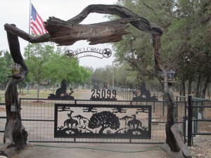
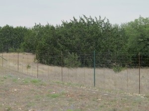
Fancy gates do not a working ranch make; I passed a lot of these designer ranches in the Utopia-Vanderpool area. Far different from the dirt ranches further west!
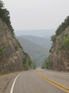
Looking back at the hill I’ve just climbed—a few miles north of Vanderpool. It was steep, but relatively short.
North of Vanderpool, Route 187 climbs steeply for a couple miles. This was the hill that the couple from Hunt had warned me about. Yes, it was steep—but it was mercifully short. I think the total elevation gain was 600 or 700 feet—far less than those grueling 2,500-foot elevation gains in the mountains further west! I was also aided by a south wind! As I’ve thought about it over the miles (and I’ve had some time to consider this), I’d take hills over headwind most of the time.
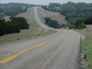
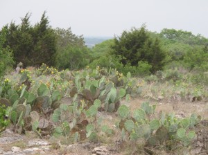
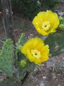
I don’t think the climb took any more than 20 minutes. At a rest area on top I took photos of the prickly pear cactus growing in profusion there. Then I enjoyed the gentle downhill curves, interspersed with periodic rises to climb over ridges and hills. In general, it was a pretty easy route—again, aided by a favorable breeze.
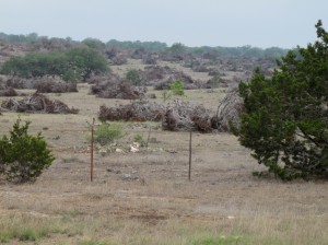
They seem to be selecting for oak in this land-clearing operation. That could backfire, as an oak blight is wiping out some of the oaks around here.
Near the northern end of Route 187, after crossing into Kerr County and just before it T’s into Route 39, I noticed the contrast between the ranch on the left (northwest) and the ranch on the right (southeast). The Menagerie Ranch on the left was horribly overgrazed. Most of the vegetation—and even topsoil—was totally gone. The elk and other exotic game animals here were clearly at too great a density for the land. The difference between the vegetation on the road allowance and on the ranch land was dramatic.
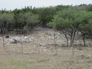
Horribly overgrazed land on the Menagerie Ranch—where I saw elk and some other exotic big-game species.
By contrast, on the other side of the road, Faulkner Ranch looked great. Here, the land within the fence looked to be in better shape than that in the road allowance. I gather that both ranches are game preserves for private hunting, but the differences were huge.
A saw several large tom turkeys along here as well as a smattering of white-tail deer and some exotic species that were penned in. I got a photo of one deer.
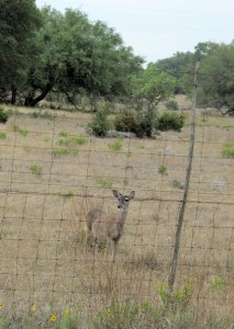
I believe this is a standard, native whitetail—though there are so many exotics in this area, it’s sometimes hard to know for sure.
Route 37 pretty-much follows the Guadalupe River—another river with water in it! It’s a wide, but very shallow river most of the places I saw it. Unlike the Sabinal River, bald cypress wasn’t as dominant.
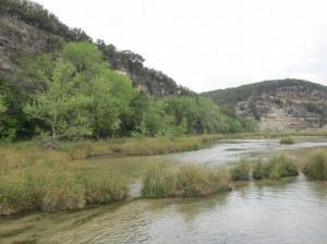
Route 37 must have crossed the Guadalupe River nearly a dozen times; each view of the river was different.
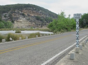
At every river crossing there were warning signs about risk of flooding, and I’m told that residents stockpile food for times when they’re trapped by floodwaters.
Nearing Hunt, about 45 miles into today’s ride, I was about to start paying attention to various landmarks, hoping to visit the couple I had met last night in Utopia: Cheney Bryan and Lyn Thrasher. I didn’t need to. They drove past me, turned around, and pulled over. It turns out, their house is quite a bit west of Hunt, and I had just passed it. It was only 12:30 or so and I had plenty of time (with less than 20 miles to get to Kerrville), so I turned around and followed them up to their beautiful house. They were impressed not only with how quickly I had made it there from Utopia, but also that I was able to bike up the steep road to their house—the secret is low gears!
I got the full tour of the place, including the various deer racks and mounted wild turkeys on the walls and a few current construction projects. I also showed Lyn how to find my blog on her new iPad, enjoyed some delicious sweets, chocolate milk, and water, and generally had a very relaxing hour-and-a-half, before I decided to push on to Kerrville. I could have stayed with them, but I’m hoping to get pretty far tomorrow, so an extra 20 miles today would be significant.
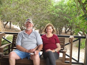
Cheney Bryan and Lyn Thrasher treated me like royalty in their beautifully appointed home. (I’ve learned not to bring up politics around here!)
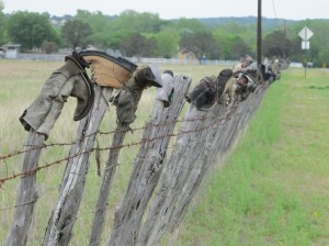
Just after leaving Cheney and Lyn’s place, I passed this “boot fence.” I gather that it’s somewhat of a landmark.
From Cheney’s place in Hunt, the ride was quite easy to Kerrville—less up-and-down, but more traffic and still no shoulder. Here in Kerrville, I’m disappointed to be so far out on the outskirts of town; when I made the Motel 6 reservation, I hadn’t realized what a large city Kerrville is (22,000); I should have found a place that would be on my route tomorrow—and closer to more restaurants.
As it is, I just got back from dinner at IHOP. The big revelation there was realizing that if I were someone’s guest, I’d now qualify for a senior discount. “Being a senior has its perks,” reads the sign, “Buy 1 meal, get one free.” The discount applies to those of us 55 and older—though only from 3 pm to 6 pm—us geezers have to get home to bed!
I find a satisfying irony in the fact that I’ve just bicycled 1,500 miles to Kerrville and walked a half-mile from my motel—to learn that I qualify for the senior discount!
Tomorrow, I’ll head toward Austin, spending one night in Wimbereley, at Alex Long’s house. Alex, an EBN subscriber, saw a note in the most recent issue about my sabbatical, my bike trip, and my blog, and upon checking it out was surprised to learn that I’m in his neck of the woods. He’s provided some great guidance for my adventures.
It’s hard for me to believe that I started this trip a month ago already: loading up the bike on March 24th in San Diego and venturing out to find the “starting point” at the Pacific Ocean. I’ve now come 1,558 miles since then. I’d still like to get a bit further east to see some lush green vegetation—but I’ve been hearing about all the rain, thunderstorms, and tornados further east. If I run into much of that, it could take some of the shine off my desire for continued travels.
Senior discount: I got my first senior discount when I was 55 in NJ. A free cup of coffee!
Got my first senior meal summer before last when Michelle, Kathy Lapan and I rode around Lake Champlain.
It was in Keeseville, NY near Au Sable Chasm.
You’re doing great, Alex, one turn of the wheels after another. Isn’t it great to be seeing green again? True here in Vermont as well! Now that you’ve seen a boot fence, keep an eye out for Texas bottle trees. Tailwinds…
One clarification…”Kim Miller and Alex Long’s House”…my bad that I haven’t properly introduced my mostsignificantsweetiepiehoneybunch…
Happy/safe riding today…see you in Fischer later…
Hi Alex,
Alex Long sent me your blog this morning, as you will be visiting my “little piece of heaven” this afternoon in Fischer! I am thrilled and delighted to have you visit, only sorry my husband Stanley had to be in Austin today. jan
Funny, I never pegged you as a big chocolate milk guy. Guess I was wrong!
it’s been so much fun following your travels via blog! as with every entry, thanks for all the great photos! everyone in old lyme says hi and happy easter and sends big hugs- we were all talking about how very cool your trip is!!
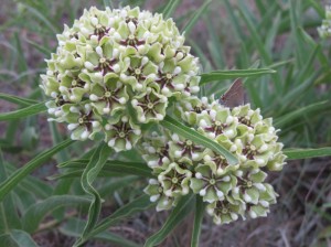
I actually found the butterfly on the milkweed-type plant. That was tough, like Nick’s search and find books. Thought maybe with my changing eyesight I might be ready for the senior discount sooner than expected.
Utopia is beautiful and you are amazing!
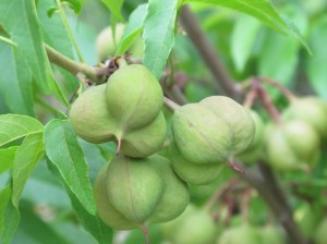
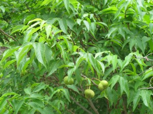
The seed pods on the tree photo in question is a “Buckeye”, seeds are black in color and about a 1/2 to 3/4 inch in diameter and are unlike the large buckeyes in the Midwest.
Thanks Gary. -Alex