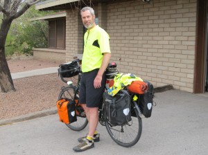
Getting ready to head out at the not-so-bright-and-early time of 9:50. I'm in front of Lee Herman's house in Las Cruces--what a great host! Click on any image to enlarge.
10 April 2011. I was undecided last night as to whether I would take a “recovery†day in Las Cruces, or press on. I figured that either way, I’d take it easy in the morning. If I decided to leave, I only wanted to get to around El Paso.
In the morning, though, I considered the situation a little more closely. The weather forecast was for a west wind of about 20 mph—ideal for biking, as long as you’re going eastward. I realized that it was Sunday; El Paso is a pretty big city with significant rush-hour traffic—so better to get past there as much as possible on a non-work-day. And finally, my experience with the wind in Hatch took quite a toll on my confidence. If I could have a good day, that might do a lot for me emotionally.
So, I decided to go for it. I awoke around 6:30, but read some of the Times, studied the weather forecasts, video-chatted with Jerelyn (my hosts are both in the software business and have a very fast Internet connection), read new comments on my blog (which I love to read each day!), dealt with the laundry that I had done the night before and hung in the garage, and cleaned my bicycle chain and my panniers. Throw a little breakfast in, and I didn’t get off until almost 10 am.
When I studied the Adventure Cycling maps a little more carefully, I realized that the only place between Las Cruces and El Paso that was listed as having a restaurant was La Mesa—a scant 17 miles from my starting point. Though I wasn’t terribly hungry, I decided to stop there for an early lunch—I think I got there around 11:15 or 11:30; they had just opened.
While eating lunch I did my usual study of the map. The only town showing a hotel that was on the other side of El Paso was Fabens. I knew it would be a push the get that far, given the late start, since my iPhone told me it was still about 65 miles away. I checked out the motel online (reasonable rates starting at $48) and called to see if they had rooms. Not a problem. Because I wasn’t sure I’d make it that far, I didn’t reserve a room, but the man who answered said there was no way they’d sell out.
So, I set my goal as Fabens. If the tail wind kept up it should be doable, and getting that far would do a lot to restore my confidence.
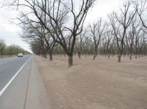
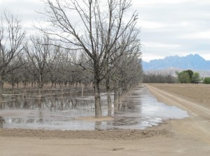
In some places along Route 28 the pecan trees were growing right up to the shoulder. Once in leaf, the shade would be nice!
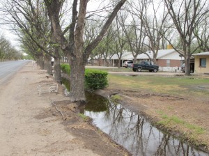
Here, some pecan trees (and irrigation) have been maintained where residential development has gone in. Edible landscaping!
Throughout much of the day today, but particularly along Route 28 through San Miguel, La Mesa, and Chamberino (in the Rio Grande valley), I was biking past mile after mile of pecan groves. I had had no idea that pecans were grown in New Mexico, but it turns out that New Mexico is either number one or two for pecan production (the other big producer being Georgia) and is usually number one for quality.
As I have throughout the trip, I stopped often to look at how the irrigation is done. As with almost all crops I’ve seen, starting back in California’s Imperial Valley, it’s all about flood irrigation. In New Mexico, irrigation water flows through “acequiasâ€â€”community-controlled and maintained ditches into which water is diverted from rivers. Some of New Mexico’s acequia associations date back to the 17th century. (I remember reading somewhere that New Mexico’s acequia associations are the oldest continually operating government structures in the U.S.—significantly predating our current federal government.)
If you want to get a good idea of how acequias work—and the strife that sometimes arises when water rights have been sold downstream—read John Nichols’ The Milagro Beanfield War. I read it back in the ‘70s when I lived in New Mexico; it’s a fantastic book that will have you laughing out loud at times!
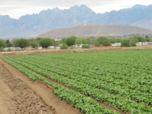
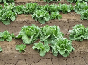
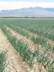
While I didn’t see many vegetable growing operations, I did pass a few—growing lettuce and onions. Mostly, the agriculture I passed was pecan production—plus some alfalfa and some beef.
Aided by the tailwind, I made great time today: averaging 15.6 mph—my fastest average so far on this trip. (My bicycle computer—a multi-function odometer and speedometer that most serious bikers use—stops when I stop to take photos, wait for a green light, or buy a cookie, so the average speed only accounts for actual riding time.)
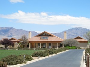
I think I saw this house on a brochure of the Copper Development Association (trade association for the copper industry). Note the copper roof. Sure makes the folks at that Santa Rita Copper Mine happy!
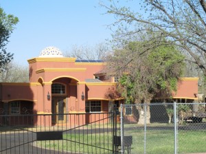
Another fancy house I passed in Texas. If you look closely, you can make out an array of PV (solar electric) panels on the roof of this house in Texas.
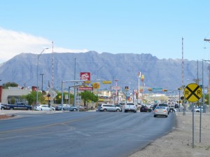
El Paso is a trip. I more time I spent pedaling in the city, the more motivated I was to push on to Fabens. El Paso seems to go on forever. Mesa Drive is one massive, six-lane shopping strip that I was on (with minimal shoulder) for nine miles. There was a fair amount of traffic, but I can imagine that it’s far worse during the week.
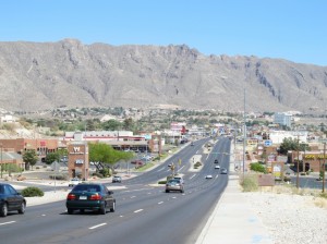
At least if you're stuck in traffic here you could gaze at the mountains! Not very bicycle-friendly--but not too bad on a Sunday.
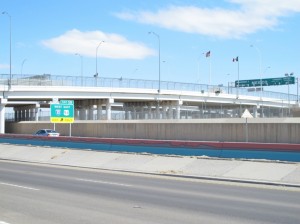
From Mesa I got on Delta Drive, which for a while runs right along with Mexico border—separating El Paso from Juarez. Two parallel chainlink fences topped with razor wire mark the border here—quite different from what I was in Arizona, but seeming quite prison-like, nonetheless.
Leaving El Paso—finally, after probably 25 miles in an urban area—the pecan production resumed, though signs announcing new housing developments and for-sale signs on some pecan farms portend continuing sprawl from El Paso.
By the last ten of today’s 83 miles, my leg muscles were a bit sore, but this has been my first pedaling day with no knee pain! Perhaps that glucosamine has now kicked in fully—or perhaps the absence of hills or the need to push against the wind had something to do with that!
I got into Fabens around 5:30, then had to bike another couple miles to the Interstate 10 exit outside of town. Total miles today: 83. Total for the trip: 919: At the motel learned that the cheapest room rates are really $58 ($65 with tax), not $48, as was indicated on the website. False advertising?
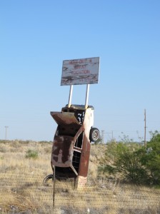
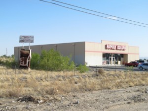
I believe this is a real estate sign, though the letters of the sign are as worn off as the car's paint.
Tomorrow, the forecast calls for less ideal biking winds than I had today and warmer weather. (I don’t think it got above 60°F today; I wore my wool jersey nearly all day.)  I am likely to get some modest headwinds at times. I’ll also be climbing about 1,200 feet up the Quitman Mountains, at a relatively gradual grade. My choices will be camping or a motel in Sierra Blanca (65 miles from here), or a motel in Van Horn (100 miles from here). I’ll play that by ear.
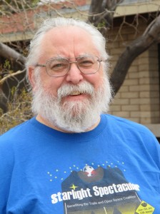

Hey, Alex, it was great to meet you. For the record, I’m squinting because of the sun, not frowning! I’m glad the day went well. Very nice pictures of the valley and the fields. Happy trails! (or more properly, roads).
It’s been fun to watch your progress, Alex. I don’t know how you have the time and energy to write so much after some of those hard days. It’s a credit to your good physical condition AND your dogged determination to get the words down no matter what. So count me as one of your fans, cheering from a distance!
Hi Alex, I just wanted to let you know how much I enjoy reading your posts. I’ve never been to the southwest, but with all your photos and wonderful descriptions, I almost feel like I’m tagging along – without any exertion on my part! Continued safe travels to you and keep up the the great blogging. I look forward to each new day’s adventure!
Just catching up with your tales after a few days visiting a friend near Ft. Lauderdale. Thought of you when biking on a clunker 1-speed through the Everglades. Saw a great blue heron stalk and stab a baby alligator, flying off with it dangling from its beak while the mama reptile had a bit of a tantrum nearby. I guess she’d been asleep at the switch. I never realized alligators care for their young, but once I focused on the area, I could see a bunch of the little ones clustered along the edge of the wetland. Sounds like you’re having some good adventures and conversations. Safety comes first and I was glad to read that you got help when you needed it. Didn’t we all learn when we were little: “Libraries are your friend”?
Great posts and I’m enjoying seeing the country from my chair and laptop. Good on ya, Alex
Hi Alex,
Trip sounds great. I’m enjoying the posts. I had great success awhile back with glucosamine with cats claw extract. I’ve taken glucosamine for years with mixed results. This stuff helped. I’ve only found it available from Shaklee, a company you have to be a member of or get their products through someone who is a member. Take care.
Hi there, I log on to your blog on a regular basis.
Your humoristic style is witty, keep it up!
I read a lot of interesting posts here. Probably you
spend a lot of time writing, i know how to save you a
lot of time, there is an online tool that creates unique,
google friendly articles in minutes, just search in google – laranitas free content
source