26 March 2011. Before I get into today’s pedaling adventure, I have to relate a follow-up to yesterday’s story about my recovery from the cold at the Descanso Junction Restaurant—my salvation from poor planning.
As soon as I turned out the light in my motel room last night (at the Pine Valley Inn and Motel) and began thinking over the day—a flow of mine that often keeps me from falling asleep quickly—I realized that I hadn’t hung up my yellow biking jersey to dry with all my other gear. Where was it? I turned on the light and looked through everything. It wasn’t there!
After a bit of reflection, I realized that I had left it at the Descanso Junction Restaurant—perhaps my mind still addled by the cold. I had hung it up to dry on a hook on one side of my booth and my raincoat on another. Both dried nicely. I realized that I must have neglected to grab it after donning my other (warmer) clothes.
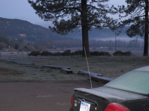
At first light in Pine Valley there was lots of frost and a temperature of about 30°F. Click on image to enlarge.
So, did I want to bike back down 2,000 feet to get it? That would be “no.” Should I call and have it mailed to me somewhere? But I didn’t know where I was going to be—and I really wanted to have the bright yellow jersey with me. I decided to try to get a ride down and back—even if I had to pay for it. (It’s only a seven-minute drive, according to MapQuest—which didn’t make me feel great, given the hour or two it took me to pedal those uphill miles.)
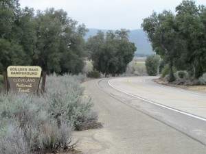
A quick stop-over along a wash at the Boulder Oaks Campground. The Pacific Crest Trail passes by here. Click on image to enlarge.
There’s no taxi in Pine Valley. The nice woman behind the desk at the motel said she could take me, but not until her shift was over at 9:30. So I went over to the local diner, which opens at 6 am. (It was about 6:30 then—I had wanted to get a bright-and-early start to the day.) I thought perhaps there would be a kitchen helper who could run me down and back for $15 or $20, but there were no available employees to do that. (The owner of the Descanso Junction restaurant, whom I had phoned, said the same thing when she called back—she was working there alone.)
The only customers in the diner were four men. I explained my situation, and one of them, Jim, said he was driving down that way shortly and could give me a ride down. I figured I could hitchhike back. It turned out that he gave me a lift back as well—and we had a chance to chat about fishing, hunting, all the problems caused by liberals, and such. A nice guy, despite his politics.
So I had my yellow jersey!
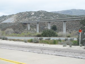
Why the Interstate highways have less up-and-down. They span those dips and blast the ridges. Click on image to enlarge.
I bundled up for ride. It was about 30°F, frost on everything. I knew it would be chilly for a good portion of the ride—until I dropped down out of the mountains into the Yuma Desert and the Imperial Valley. I wore my bike shorts, these somewhat-insulated tights I have over the shorts, my bike shoes with insulated covers over them, the lost-and-found yellow jersey, my long-sleeved black wool stretch jersey, and a yellow vest over that. I figured that after I got to the top of the first rise—just a few miles east of Pine Valley—I would also put on my yellow windbreaker for the thousand-foot drop in this roller-coaster route through the mountains. Oh, and I also had on my insulated deerskin gloves (not real biking gear, but fairly warm!).
I think I kept the yellow windbreaker on for the next 50 miles until the bottom of the long descent into the valley. Even with that gear, my feet got cold for a while.
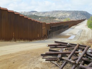
The infamous new border fence on the Mexican border, just west of Jacumba. Click on image to enlarge.
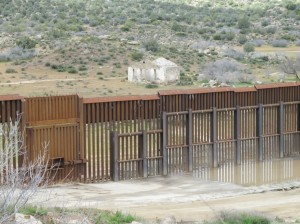
Detail of the border fence. I didn’t get close enough to figure out if some wildlife can squeeze through–something I’ve long wondered about. Click on image to enlarge.
In certain respects, it seemed as if today really started my bike trip. I was done with the initial nervousness. It wasn’t raining, and I wasn’t dealing with (much) traffic. I could look around at the beautiful terrain as I wound through the mountains. Mostly barren, rocky escarpments, but frosted with sagebrush.
I made it to Jacumba by noon after a long, cold descent from In-Ko-Pah Pass (where I took a slight detour to photograph a windfarm of 25 huge turbines). As with lunch the day before, refills on hot tea helped warm me. All morning it had been cloudy (and even threatening rain a few times), but when I left the Jacumba Hot Springs Spa and Lodge after lunch, the sky was blue—still cool, but sunny.
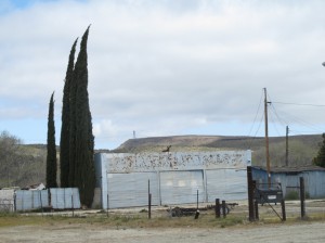
“Pointer trees” on the north side of the road telling my which way I should be pedaling! Click on image to enlarge.
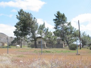
More wind-swept “pointer trees”–these ones on the south side of the road. Go with the wind! Click on image to enlarge.
All this time, I had had a great tailwind—probably a steady 20 mph. Rising out of Jacumba for the last hill climb before a 3,000-foot drop into the Imperial Valley, I was actually able to coast on a slight incline! Just to experience the difference, I turned around at one point and tried pedaling downhill—far more work!
As the descent began, Old Route 80 merges into I-8 (Freeway in California-speak). There are a few stretches where you can bicycle on freeways (where there isn’t any other route). The descent on I-8 was fast—and harrowing. The shoulder is very wide, with a rumble strip between me and the traveled lanes, so I wasn’t so worried about vehicles. But the wind is a real challenge.
One fairly intimidating sign warned of extreme wind the next 12 miles! The truck speed limit was 35 mph in places; there was a runaway truck escape ramp; lots of curve warnings—you get the idea. At one point I glanced down at my speed gauge and saw that I was going 42 mph! It took absolutely full concentration controlling the bike in the wind—but was exhilarating. As we dropped elevation you could also feel the temperature rising.
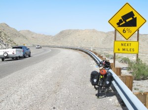
The 3,000-foot descent was harrowing with shifting cross-winds. I’m parked on a pull-over area; the shoulder is visible next to the traveled lane. Click on image to enlarge.
Finally, near the bottom, bicycles have to exit and continue on a more suitable highway. Still that wind was at my back. I stopped in Ocotillo to fill my two larger water bottles that I hadn’t used during the previous two days, with all the climbing. There, I got into a great conversation with someone about to get out of the military and planning to bike to Alaska; he was interested in hearing my experiences with the panniers I have. Shortly after that, back on the road, I chatted with someone pedaling the other way (the wrong way, wind-wise) en-route from Orlando and then heading up the Pacific Coast and back across the country further north—a real trooper!
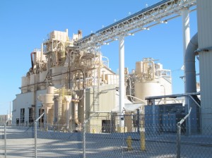
Who doesn’t love a drywall factory! This is in (this IS) Plaster City, California. Click on image to enlarge.
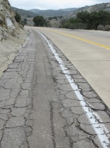
The rest of the ride to El Centro was easy, though the road was in horrible condition—by far the worst I’ve seen. Fortunately, there was almost no traffic. I stopped periodically along the way to take photos, such as the U.S. Gypsum Plaster City drywall plant. As the afternoon progressed, the wind only picked up in intensity. By the time I rode into El Centro, wind was pulling up significant dust storms.
Here in El Centro, I’m staying with a WarmShowers host. The very nice couple invited me to join them for dinner. Interesting conversations. He’s a very experienced bicyclist (though not bicycle touring), so I picked up some useful info about the roads around here. It was a good day. With all the downhill and the tailwind, I covered 76 miles. Looking forward to tomorrow’s adventures!
Sounds like another eventful (and adventurous!) day. And thanks for all the detail! I really feel like I’m part of the trip.
Bob
Great to read about your first few days of adventure. The border fence pics were chilling, but the human to human story of how you got your yellow shirt back was heartwarming. Looking forward to future blogs.
Who, indeed, does not love a drywall factory. And with such a great name!
Alex, this is great! Looks like your new computer is working out. Keep us posted!
42 mph!!!???